Navigating CDMX
Heading east from Zitácuaro, we had to make plans for contending with the behemoth of Mexico City (CDMX). If you’re traversing Mexico (north to south or east to west) at some point you will have to contend with this mega-city. Without taking some bizarre routing, it’s basically not going to happen any other way. And really there’s nothing to worry about. At least there’s nothing to worry about now. At the time, I was extremely stressed out.
I knew that CDMX had rules about who could enter the city and on what days – part of early research that I tucked away to recall when we got closer. If we avoided driving right through the heart of it, I reasoned, we should be fine. And then I started to dig into the details…
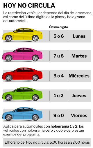
‘Hoy no Circula’ is the name of the program. It’s not what days you can drive, but the day(s) you no circulo (days for which that there is no ‘circulation’). Restrictions are based on your license plate’s final digit. For example, if your license ends in a 9 you can’t drive on Fridays. If it ends in a letter (which is very common in Canada, and not uncommon in Mexico for that matter) then you are with the 9s and 0s as well. No one can drive on Saturdays (different rules for permitted cars and locals, but we’re not talking about that). You can find a great summary of what it means for drivers here – what days for what drivers, rules for emissions, visitors, residents and all the rest of it. However, the information is not quite right (although I applaud the attempt) and I was pulling my hair out trying to get to the truth.
The first error, I got to the bottom of with minimal grief. Once it was clear that we would have to enter the city precincts on a day on which we were not permitted, I had to explore other options. The most straightforward was a visitors permit. Of course, I reasoned. They had to offer a way for non-residents to circumnavigate the system; a few tourists travelling through were not the real problem. For us, it was not to be. Our car is a 2007 and the cut-off for a permit is now 2008. You won’t find this on (any of?) the english language blogs which all seem to reference regulations now out of date. Our little car, apparently is too old, potentially too great a polluter (which is kind of hilarious). So what now?
Now I was a bit worried. I needed to make sure we did not enter the ‘No Circula” zone or face a hefty fine and a conversation with transit police that I’d rather avoid. How wide would I need to traverse to make sure I was safe? What I found online had me very worried. CDMX is it’s own thing, own boundaries, it was clear I couldn’t drive there (and was happy not to). Yet what I was reading was suggesting the entire state of Mexico (yes, there’s a state* in the country of Mexico, surrounding the city of Mexico, and they all share the same name), a rather large area, was off limits. What I read in several places was this: The Hoy No Circula program is in force in all areas of Mexico City as well as the State of Mexico. Like, the whole thing? How?
This, I knew was ridiculous. The problem was, I didn’t know how ridiculous. After much digging, I got a list of municipalities in the State that were part of a program. Again, I was faced with a roadblock – where exactly are these municipalities. Then I got an outline and tried to match it with my Google map to see what highways might cross within its boundaries. In the end, none of this was necessary.
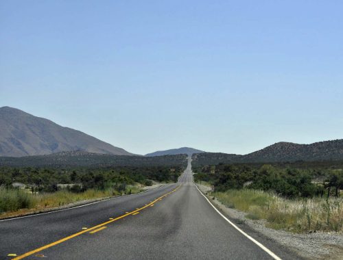
Highway 57d is your friend, skirting the ‘danger zone.’ You’ll pay a ton for tolls, but if you’ve made it this far you likely already knew that. It’s the long way round, yes, but with good signage, lots of lanes, and you miss the city entirely.
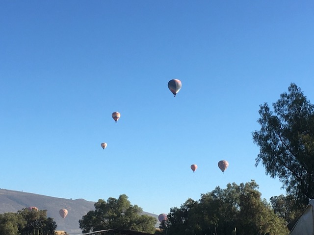
So we made it to Teotihuacán. There is an amazing pyramid complex here, a top day trip from CDMX, but we didn’t have time to visit (I had to cut back some days as we hustled to Veracruz). All for the best as the place felt like it was under siege with endless firecrackers. This may sound like I’m being fussy, but it was not stop bombardment. At 6am they began again and we got out of there as quick as we could. The cover photo is of the balloons that filled the early morning skies, a bird’s-eye view of the archaeological zone. From there, we continued clockwise round CDMX towards Puebla, before turning east and descending back to sea level**.
*Side note: try and simply find a map of the state of Mexico. It’s bloody near impossible. Every day it gets harder to merely use the internet for very low-key do-goodery. This is the future we deserve.
**It was freezing in Teotihuacán making us eager for coffee in the morning. But at these heights it doesn’t get very hot! We totally forgot about low pressure at elevation – water boils too easily. Time to get out of the mountains…